Northern Bus Corridor – City Road Zebra Crossings and Bus Lane
Cardiff Council is proposing measures to provide new pedestrian crossing facilities and improve existing ones along City Road. This would help people travelling to and from the local shops.
A new bus lane on the lower end of City Road is also proposed. This would help prioritise sustainable transport and improve bus journey times. Changes to the bus stop locations along this route are also proposed.
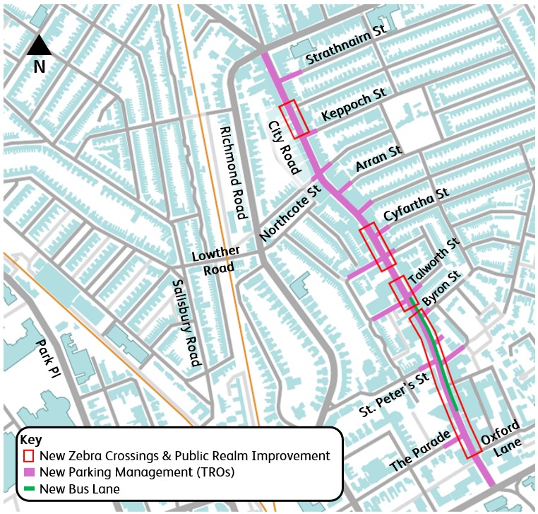
As part of the proposals, new parking and loading arrangements are also being introduced on City Road and part of the side streets. This would help with the turnover of parking which makes it better for local businesses and residents.
Parking zones for the wider area are also being developed. Find out about the parking zones proposed for Plasnewydd on the Council’s main website.
New parking and loading restrictions need a Traffic Regulation Order (TRO). Those will be consulted on separately as part of the legal TRO process.
You can view the City Road engagement pack or the City Road site plan.
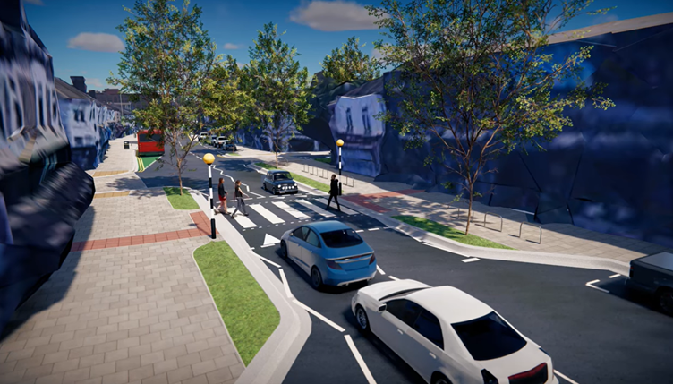
To help you visualise the proposed changes, we have created a ‘fly-through’ video here.
Key features of the proposal
The key features of the proposal include:
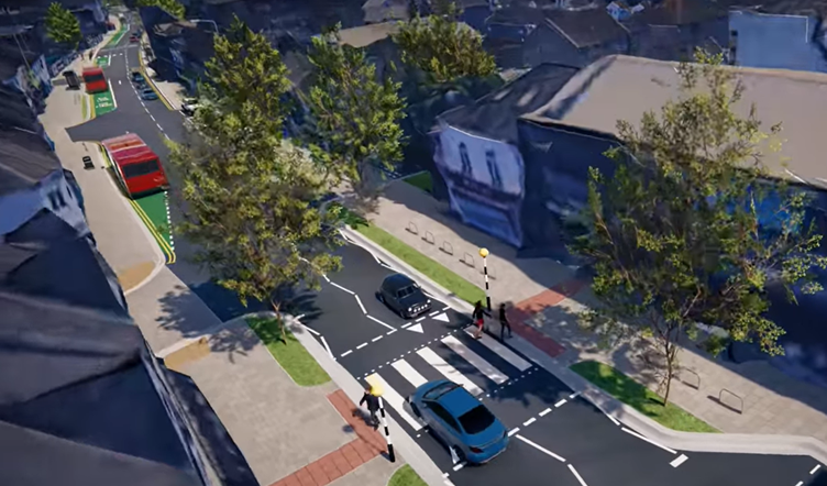
3 new zebra crossings
We would introduce 3 new zebra crossings near the junctions of:
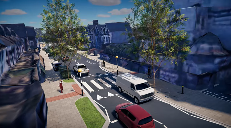
Keppoch Street and Glenroy Street
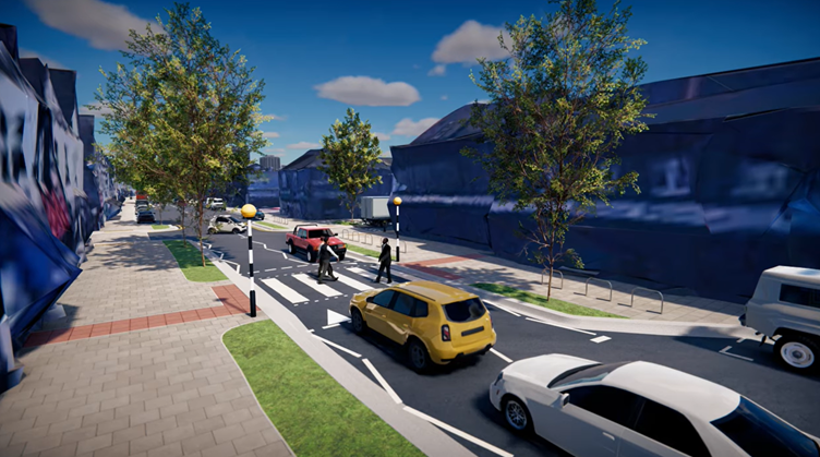
Cyfarthfa Street, Pearson Street and Tavistock Street
Talworth Street and Penlline Street
Improvements near Shakespeare Street
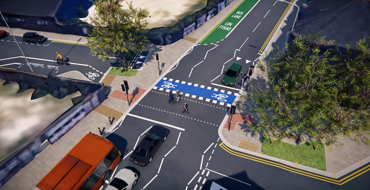
A cycle lane onto Shakespeare Street and Milton Street will be provided. The lane would be mandatory contraflow which means cyclists would travel in the opposite direction to the 1-way traffic system. This improves access for cyclists.
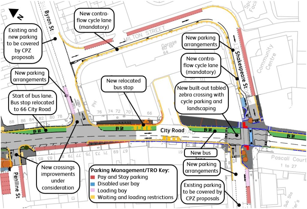
There will be an upgrade of the toucan crossing near the Shakespeare Street and St Peter’s Street junction. This would include a ramped area and better protection of the cycle link into Shakespeare Street.
Crossing change near The Parade
The existing zebra crossing near The Parade is likely to be changed to a puffin crossing (traffic signal push button).
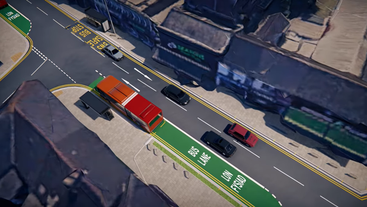
New bus lane
A new bus lane will be introduced on City Road between Talworth Street and The Parade.
New bus stop and shelter
We would provide a new bus stop and shelter next to 66 City Road and remove the stops near the Earnest Willows and 84 City Road. This would improve bus journey times.
Funding
We are looking to get funding from the Welsh Government Transport Fund grant and also from developer contributions (known as Section 106 funding). We are aiming to deliver this scheme in the 2026 to 2027 financial year.
Engagement
The engagement took place between 4th July 2025 and 17th August 2025. The engagement report is available to view on the Councils Website.